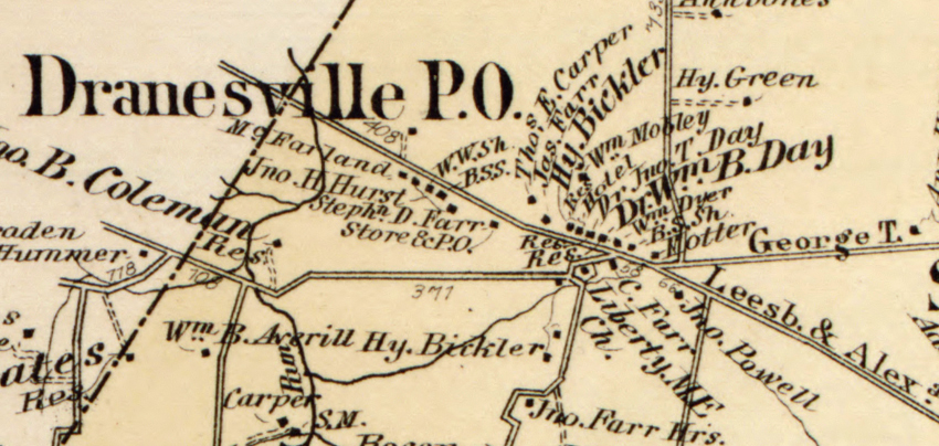
The Lost Town of Dranesville
Dranesville Elementary School, and the Dranesville Magisterial District, take their names from one of the five lost towns of Fairfax County. All but erased by the passage of time, the lost towns include Colchester, Dranesville, Matildaville, Union Mills, and Wiehle. These once vibrant communities of homes and businesses played an important role in the history of Fairfax County.
The Founding of the Town
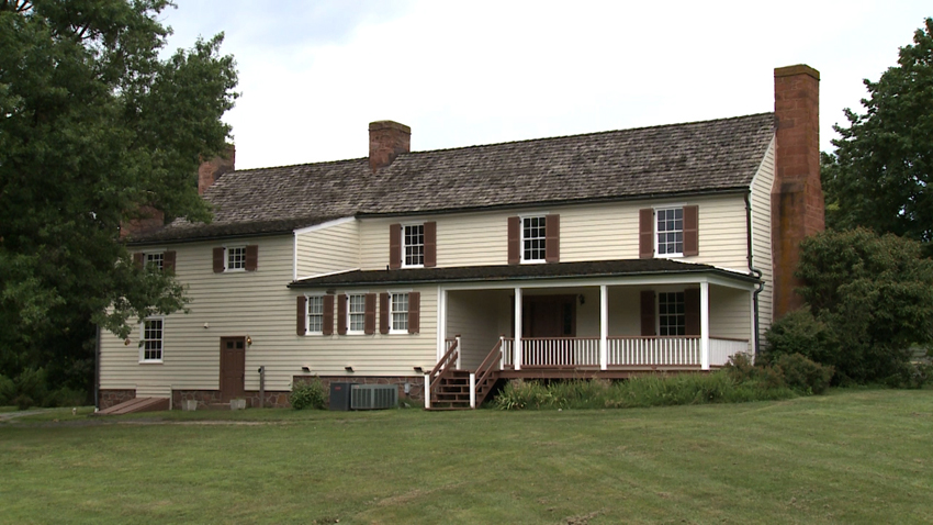
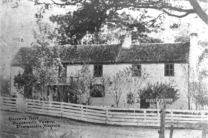
In 1810, Washington Drane moved to what is today the intersection of Georgetown Pike and Leesburg Pike. He opened an ordinary–a combination hotel, store, and saloon–and named it Drane’s Tavern. Ordinaries provided lodging, food, and drink for travelers, halls for local entertainment, stabling for animals, and meeting places for community members. It was a two-day trip by wagon from Leesburg to Alexandria and Georgetown. Recognizing this, Washington Drane located his ordinary at the halfway point in the journey. Soon the area around Drane’s tavern flourished. A church, a post office, a store, doctor’s offices, residences, and four more taverns opened.
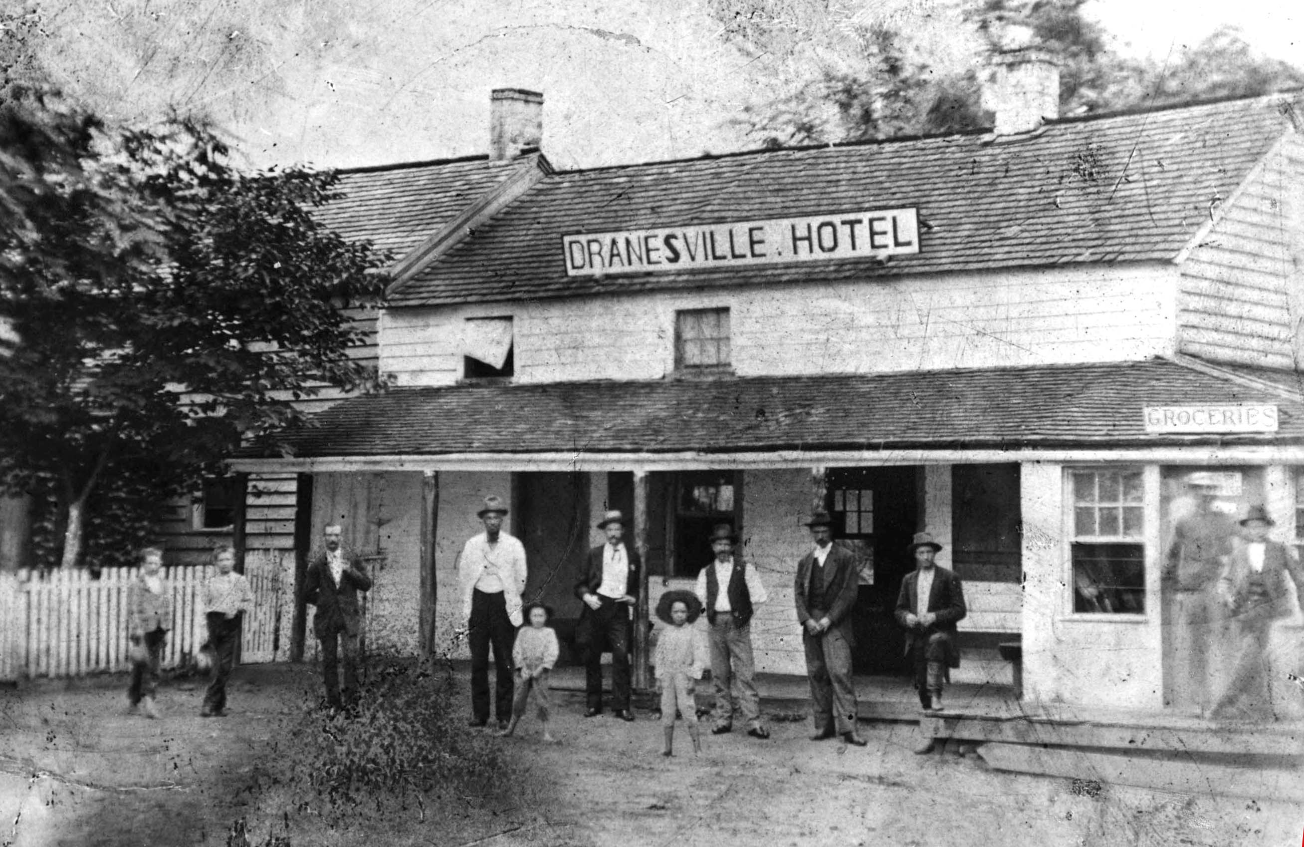
From the early 1800s to the early 1900s countless people, wagons, horses, cattle, sheep, hogs, and turkeys traveled through the hamlet of Dranesville from Loudoun and the Shenandoah Valley to the eastern destinations of Georgetown and Alexandria. Many of the drovers and their livestock spent the night at Dranesville. For example, from 1815 to 1830 it was commonplace for 40 to 50 wagons pulled by four and six horse teams to daily traverse the small town.
~ Dunbarton, Dranesville, Virginia by Charles Preston Poland.
While the drovers stayed at the tavern, their animals were kept in a series of small fenced fields on the 12 acres surrounding the tavern. Herds were mixed together and separated prior to departure according to color codes painted on the animals. The facilities, plus a plentiful supply of spring water, made it possible to keep around 300 head of cattle and sheep overnight. Boys from the neighborhood could frequently earn 25 cents a day helping to drive the herds from Dranesville to Langley. They would walk and lead a horse, and would ride back home at nightfall.
~ Dunbarton, Dranesville, Virginia by Charles Preston Poland.
In 1840, the thriving village of Dranesville took on legal status when Virginia recognized it as a town.
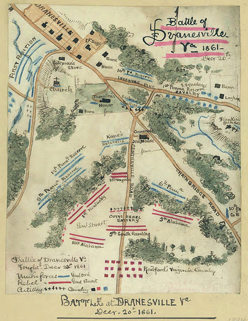
The Battle of Dranesville
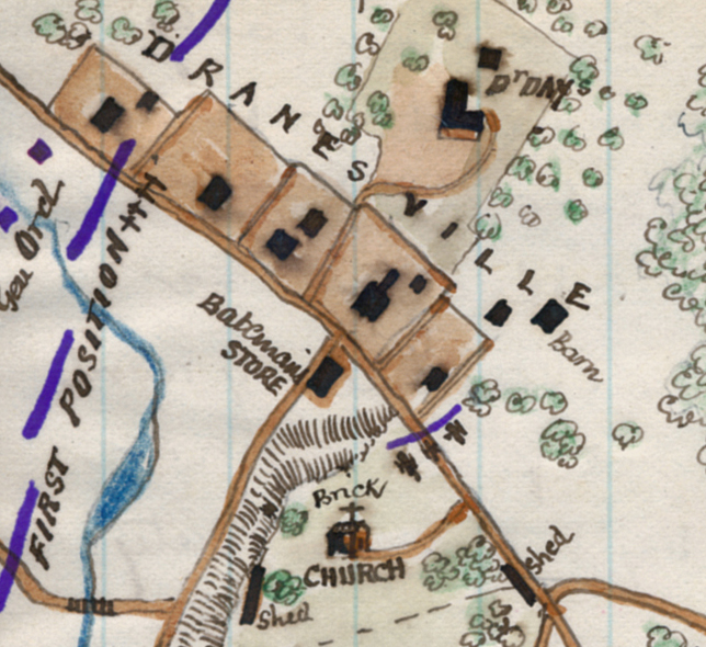
During the American Civil War, the town of Dranesville became a battleground when opposing forces of the Union and Confederate armies encountered one another along Leesburg Pike. On December 20, 1861, Confederate Brigadier General J.E.B. Stuart led a force of 4,000 infantry and cavalry north from their winter quarters at Centreville to obtain provisions and to try and learn the whereabouts of the Union Army. That same morning, Union General Edward O.C. Ord led 10,000 soldiers west from the village of Langley, intent on clearing out any Rebel forces that were stationed along Leesburg Pike. At the village of Colvin Run, General Ord divided his forces in half, sending 5,000 troops further up the pike and leaving the rest to protect his army from being cut off from their base at Langley. The opposing armies met at the town of Dranesville.
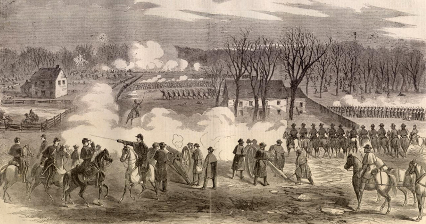
After a two-hour-long firefight, General Ord’s soldiers forced General Stuart and his army to retreat. The Battle of Dranesville became the first victory of the Union Army in the eastern theater of the war.
Dranesville in the 20th Century
The town of Dranesville reached its peak in the 19th century and gradually declined throughout the 20th century.
The creation of the railroad from Alexandria to Leesburg in the 1850s, followed by the invention of the automobile several decades later, slowly faded Dranesville’s importance. The widening of Leesburg Pike in the late 1960s led to the demolition of many of the older buildings in the town.